Photogrammetry is the science of making measurements and mapping from digital or hardcopy photographs. Aerial photogrammetry enables the accurate mapping of 3D coordinates on the ground, using 2D coordinates measured on stereo aerial photographs that see the same points on the ground from two or more different perspectives.
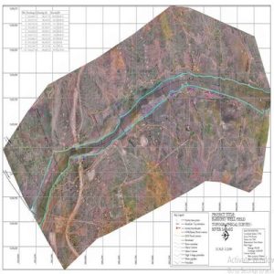
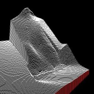
Photogrammetry is typically used to create topographic maps which depict the three-dimensional shape and features of the ground onto a two-dimensional surface, and can also be used to produce contour line maps or Digital Terrain Models (DTMs), map corrected aerial imagery, and planimetric feature maps.
Advantages offered by aerial photogrammetry include:
Extremely high spatial accuracy achieved using calibrated metric cameras. The precise focal length, principal point coordinates, and various forms of lens distortion are carefully calibrated so that systematic distortions can be accounted for and corrected.
High resolution aerial maps and imagery allows users to realistically see the landscape from above and be used to resolve disputes that might occur from other technologies. Panchromatic, natural color or color infrared aerial photographs can be acquired from metric film cameras, or multispectral digital imagery can be acquired from digital metric cameras.
Road Aerial Photogrammetry
Do You Have Any Questions?
You’d like to talk to us about a project, or anything else, we’d love to hear from you.