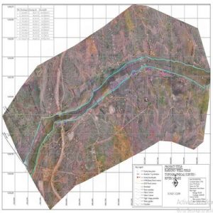
UAS imagery and associated software provides a cost-effective solution to traditional methods of stockpile and mining inventory valuations. Our mapping solutions provide topography and survey data, eliminating the costly and labor intensive conventional methods while also increasing accuracy. Let’s discuss the specifics of your project to determine the best cost-effective use of the multiple technological options available. We are innovative, proactive and enjoy challenges to find the best solution for you.
Areas where Geo-cart drones mapping can help you cut cost and save time:
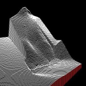
Volumetrics
Improve safety and increase accuracy while saving time & money over the conventional methods of estimating stockpiles by unleashing the power of UAS.
Energy
The infrared capabilities of UAS is an amazing tool in determining efficiency, and the malfunctioning equipment for the energy industry. The mapping of infrastructure and equipment can add valuable data for upgrading and repairing energy infrastructure.
Manufacturing
Monitoring and tracking inventory is essential to every manufacturing company but lost productivity from difficult to quantity bulk materials can be extremely costly. Volumetrics using UAS is great way to accurately count stockpiles in a fraction of the time.
Do You Have Any Questions?
You’d like to talk to us about a project, or anything else, we’d love to hear from you.