Today, Surveying Engineers play a vital role in developing societies. Their primary role is to determine the position of natural and man-made objects on the earth’s surface, and record it for future planning purposes; to set and reset boundaries both within the country and internationally. Surveying is the general term, which covers a myriad of disciplines, such as Geodesy, Photogrammetry, Cartography, GIS, Digital Mapping, Cadastral Surveying, etc.
Surveying Engineers or Surveyors collect, analyze, and manage the global spatial infrastructure. They design, develop, and operate systems for collecting and analyzing spatial information about the land, the oceans, natural resources, and man-made features. They use sophisticated equipment such as Global Positioning Systems (GPS), electronic theodolites, levels, aerial photographs, satellite imagery for gathering, analyzing, and using information about the earth. Modern Surveying topics include digital mapping, geodesy, photogrammetry, remote sensing, as well as more traditional surveying involving property surveys. Since our societies are becoming more complex, information with a spatial position associated with it are of vital importance and are critical to decision-making, both from a personal and a business perspective, and for different levels of government.
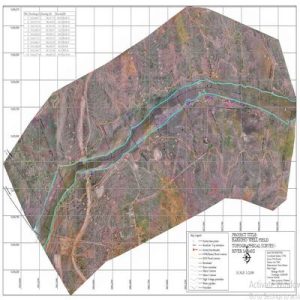
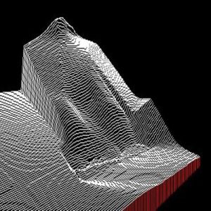
Ngara Aerial 3D photograph
Do You Have Any Questions?
You’d like to talk to us about a project, or anything else, we’d love to hear from you.